
How the Batur Caldera Was Formed
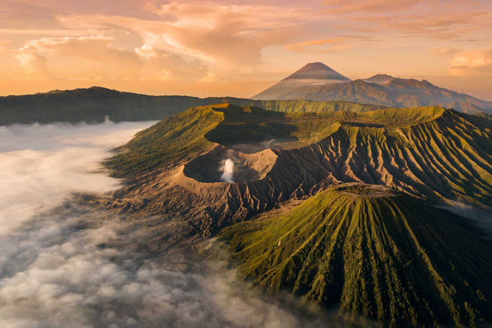
To begin with, Batur sits at the centre of two nested calderas, northwest of Mount Agung. Specifically, the larger caldera measures about 10 by 13 km and formed roughly 29,300 years ago. At that time, a huge eruption emptied the magma chamber below, and as a result the ground above collapsed like a broken lid.
Subsequently, a second collapse carved the smaller inner caldera, about 7.5 km across. Estimates put that event around 20,150 years ago, although some studies suggest an earlier date. In any case, the result is the vast bowl that now holds Lake Batur and 15 villages.
Mount Batur Eruption History and the Black Lava Fields
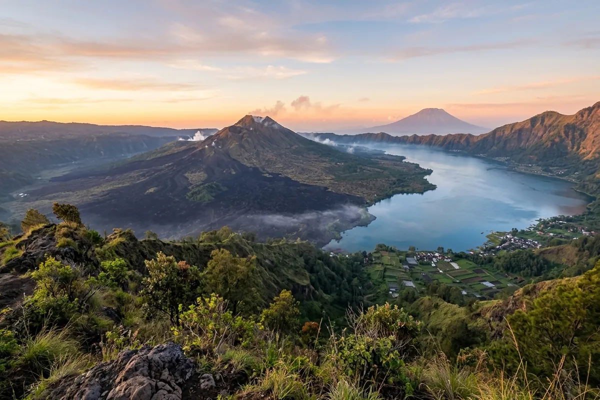
Afterwards, new eruptions built a cone inside the bowl. Today, this inner stratovolcano rises about 700 metres above the lake, and its summit reaches 1,717 metres. Moreover, each eruption added fresh layers of ash, rock, and lava.
The first documented eruption happened in 1804. Later, the 1963 eruption proved especially powerful, and it left a wide lava field that you can still see from Kintamani. Smaller eruptions followed over the years, and the most recent major activity ran from 1999 to 2000.
To summarise, Table 1 lists the key moments in Batur’s history.
| Event | Approx. Date | What It Left Behind |
|---|---|---|
| Outer caldera collapse | 29,300 years ago | The 10 by 13 km bowl |
| Inner caldera collapse | About 20,150 years ago | The 7.5 km inner basin |
| First documented eruption | 1804 | Written record of activity |
| Major lava eruption | 1963 | The large black lava field |
| Latest major activity | 1999 to 2000 | Ash and fresh vents |
Why the Lava Fields Look Black and Barren
Generally, hot lava cools fast when it meets open air. Consequently, it hardens into dark, rough rock, and years pass before soil and plants take hold. For this reason, the 1963 flow still looks stark against the green slopes around it.
For example, you will see jagged blocks, cracked surfaces, and patches where only small shrubs grow. Because nature recolonises lava slowly, the scene changes little from one visit to the next. In addition, the contrast with the lake and the forest makes the area a favourite for photos.
Is Mount Batur an Active Volcano Today?
Yes. Volcanologists classify Batur as active because it has erupted in recent history and could erupt again. Indeed, steam still rises from vents near the crater, and the ground stays warm in places. Furthermore, Indonesia’s volcano agency, PVMBG, monitors the mountain and publishes its alert level on the MAGMA Indonesia website.
Therefore, before you travel, run through three quick checks:
- Check Batur’s current alert level on MAGMA Indonesia.
- Ask your operator whether the planned route and viewpoints are open.
- Follow your guide’s instructions near steam vents and warm ground.
However, active does not mean dangerous every day. Most visits go ahead normally, and operators adjust or cancel trips when conditions change. For instance, if you plan to climb, our Mount Batur sunrise trekking packages come with a certified guide who knows the mountain and watches the weather.
What You See on a Mount Batur Jeep Tour
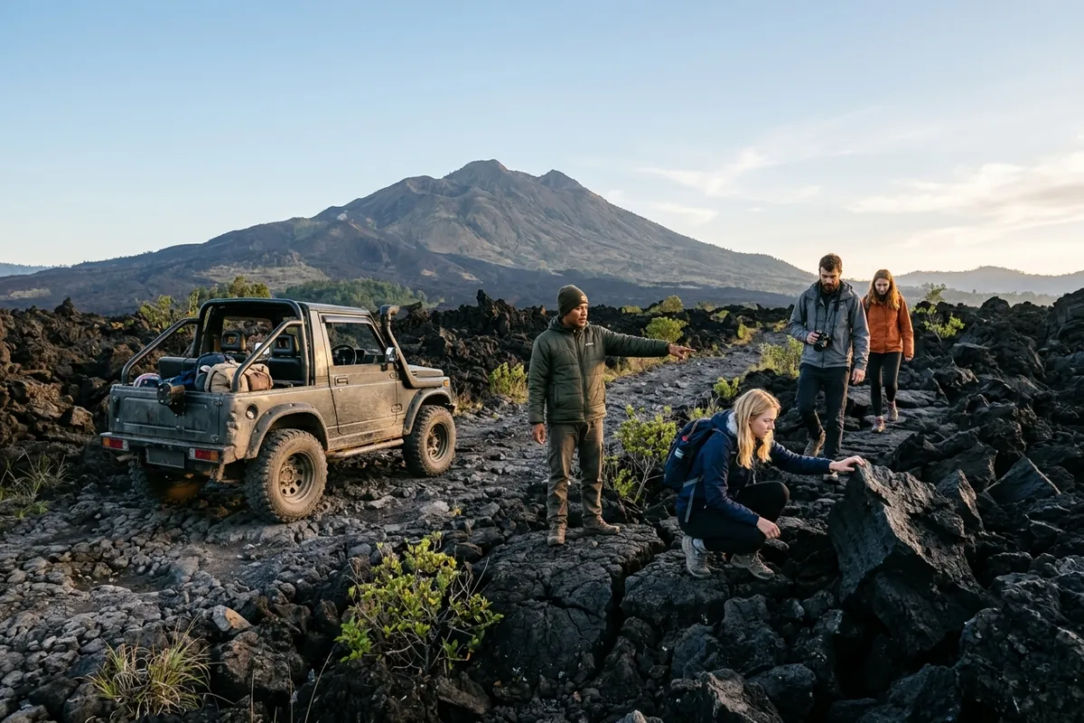
On the other hand, a jeep tour shows you the volcanic story without a hike. Firstly, your driver takes you up a 4WD route to a sunrise viewpoint high above the caldera before dawn. From there, you look down on the caldera, the lake, and the dark scars of old lava flows.
After sunrise, many of our Mount Batur jeep tour packages also stop at the black lava field, where you can walk on the hardened flow and see how raw the rock looks. Meanwhile, a local guide explains each stop. Finally, many packages end with a hot spring, which the same volcanic heat feeds. Bring a jacket, because the viewpoint is cold before sunrise.
In short, a typical jeep morning runs through three stops:
- Sunrise at a 4WD viewpoint above the caldera and Lake Batur
- A walk on the black lava field from the 1963 eruption
- A soak in a natural hot spring warmed by the volcano
Not sure whether to drive or climb? Table 2 compares the two ways to see the volcano.
| Option | Effort | Pickup | What You See | Best For |
|---|---|---|---|---|
| Jeep tour | No hike, 4WD drive | About 2:00 to 3:30 AM | Caldera, Lake Batur, black lava field up close | Families and non-hikers |
| Sunrise trek | About 2 hours up, moderate fitness | About 1:30 to 3:30 AM | The 1,717 m summit, crater rim and steam vents | Active travellers |
Visit the Geopark With a Local Team
In fact, UNESCO added the Batur Caldera to its Global Geoparks Network in 2012. The listing recognises the area’s geology and its value to the people who live there. Above all, travelling with local guides supports that community, and it gives you a safer, richer visit.
Want more than a volcano? In that case, browse the best Bali tours we organise, and message us your dates. After that, we will help you pick the right trip.
See the Volcano at Sunrise
Message Gorilla Adventure Bali your dates and pickup area on WhatsApp, and we will suggest the jeep tour or sunrise trek that fits your group before you book.
Frequently Asked Questions
Is Mount Batur an active volcano?
Yes. It has erupted several times since 1804, with its latest major activity in 1999 and 2000. Authorities monitor it, and tours run when conditions are safe.
When did the Batur lava field form?
The large lava field visible from Kintamani came from the 1963 eruption. Even today, the hardened flow still looks black and barren.
Do I need to hike to see the caldera?
No. A jeep tour takes you to a sunrise viewpoint high above the caldera, so you can see the lake and the lava fields without climbing.
How can I check if Mount Batur is safe to visit?
First of all, check Batur’s alert level on the MAGMA Indonesia website, run by the national volcano agency PVMBG. In addition, ask your operator whether the planned route is open before you travel.
Is the Batur Caldera a UNESCO site?
Yes. UNESCO added the Batur Caldera to its Global Geoparks Network in 2012, recognising both its geology and the local communities who live there.


